|
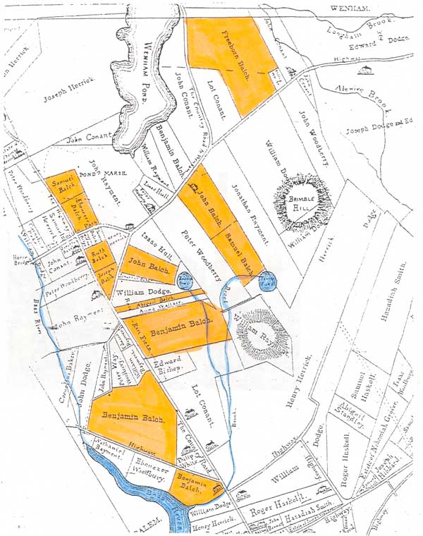
« Return Alison Woitunski, '04 Figure 2 The sections highlighted in orange show the approximate 200 acres of land that once belonged to John Balch. The blue highlights depict the location of the Bass River in relation to the Balch homestead. Raymond, Robert. Beverly, "Massachusetts Maps," Sept. 2003, http://freepages.genealogy.rootsweb.com/~raymondfamily/BeverlyMaps/BeverlyMaps.htm (25 Sept. 2003)
|
|
|