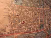
The 1852 Slatter & Callan Map of Boston

African-Americans in Antebellum Boston

We also discovered an 1852 map by Slatter & Callan that depicts every structure in the city. We photographed and digitized the Beacon Hill and West End neighborhoods in hopes of displaying our demographic information from the database on the individual residences displayed on the map.

Using Geographic Information System (GIS) Technology to Represent the Data


Untitled Document
:: STEP-BY-STEP GUIDE ::
» Introduction
» Boston Athenaeum
» Professor Robert Allison
» African-American Heritage Trail
» Beverly Public Library
» Developing the Database
» Using Tax Records
» Digitizing The Liberator

» The 1852 Map of Boston
» GIS Technology
» Using Probate Records
» Digitized Documents
» Student Research
» Selected Bibliography

:: 1852 MAP ::
» Detail of 1852 Slatter & Callan Map